
Places of India
Kerala
History, geography, economy and culture of Kerala
Wikipedia — Kerala ↗Adapted from the linked English Wikipedia article, retrieved 20 November 2026, under CC BY-SA 4.0. Headings and paragraph selections have been edited; source contributors are recorded in the linked article history. Historical statistics retain their original reference periods.
Tags: Places · Kerala
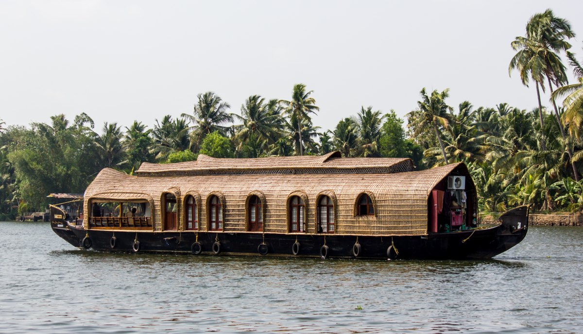
Kerala (English: / KERR-ə-lə; Malayalam: [keːɾɐɭɐm] ), officially Keralam, is a state on the Malabar Coast of southern India. It was formed on 1 November 1956 under the States Reorganisation Act, which unified the country's Malayalam-speaking regions into a single state. Covering 38,863 km2 (15,005 sq mi), Kerala is primarily a strip of coastal plains sandwiched by the Western Ghats and the Laccadive Sea, bound by Karnataka to the northeast, Tamil Nadu to the east, and the Lakshadweep islands in the western vicinity. With 33 million inhabitants according to the 2011 census, Kerala is the 13th-most populous state in India. Thiruvananthapuram is the capital city while the Kochi metropolitan area is the state's most populated region. Malayalam is the most widely spoken language and, alongside English, serves as an official language of the state. Kerala has been a prominent exporter of spices since 3000 BCE. The Chera dynasty, the first major kingdom in the region, rose to prominence through maritime commerce but often faced invasions from the neighbouring Chola and Pandya dynasties. In the 15th century, the spice trade attracted Portuguese traders to Kerala, initiating European colonisation in India. After Indian independence in 1947, the kingdoms Travancore and Cochin acceded to the newly formed republic and were merged in 1949 to form the state of Travancore-Cochin. In 1956, the modern state of Kerala was instituted by exchanging peripheral areas with the former Madras State; Malabar district and the Kasargod taluk of South Canara district were merged with Travancore-Cochin to form Kerala, while Kanyakumari district and parts of Shenkottai taluk were annexed to Madras State. Kerala consists of 14 districts since 1984. Kerala has the highest Human Development Index, at 0.784 in 2018; the highest literacy rate, 96.2% in 2018; the highest life expectancy, at 77.3 years; and the highest sex ratio, with 1,084 women per 1,000 men and the lowest positive population growth rate in India (3.44%). It is the least impoverished and the second-most urbanised state in the country. The state has witnessed significant emigration, particularly to the Arab states of the Persian Gulf during the Gulf Boom of the 1970s and early 1980s, and its economy relies heavily on remittances from a large Malayali expatriate population. Hinduism is practised by more than 54% of the population, followed by Islam and Christianity. The culture is a synthesis of Aryan and Dravidian traditions, shaped over millennia by influences from across India and abroad. The production of black pepper and natural rubber contributes significantly to the national output. In the agricultural sector, coconut, tea, coffee, cashew, and spices are important crops. The state has a coastline of 595 kilometres (370 mi), and 1.1 million people depend on the fishing industry, which accounts for around 3% of the state's income. The economy is largely service sector oriented, while the primary sector contributes a comparatively smaller share. Kerala has the highest media exposure in India, with newspapers published in nine languages, primarily Malayalam and English. Named as one of the ten paradises of the world by National Geographic Traveler, Kerala is one of the prominent tourist destinations of India, with coconut-lined sandy beaches, backwaters, hill stations, Ayurvedic tourism and tropical greenery as its major attractions. The state has also been repeatedly recognised in international travel rankings for its tourism.
Etymology
The word "Kerala" is first mentioned as Keralaputra ('son of Chera[s]') in a 3rd-century-BCE rock inscription left by the Maurya emperor Ashoka (274–237 BCE) in one of his edicts. At that time, one of the three states in the southern part of the Indian subcontinent was known as Cheralam in Classical Tamil. As per linguist Robert Caldwell, Kera and Kela are variants of the word Chera. There are several theories as to the origin of the word Kerala. Kerala might have originated from the combination of the two words chera and alam meaning 'land of the Cheras'. In Tamil literature, Cheral refers to the oldest known dynasty of the kings who ruled the Kerala region and might have been derived from the Old Tamil word for 'lake'. Keralam may stem from the combination of the words cherive and alam meaning 'land of hill or a mountain slope'. It might also have originated from the Malayalam words kera and alam meaning 'coconut tree' and 'land' respectively, thus meaning 'land of coconuts', due to the abundance of coconut trees in the region. Kerala was also called Malabar, after the eponymous coast. The region was called as malanadu or malavaram meaning 'hill country' due to its topography, which later became 'Malabar'.
Renaming to Keralam
There has been a long-standing demand to change the official English name of the state from Kerala to Keralam, the official name of the state in Malayalam. In June 2024, the Kerala Legislative Assembly passed a unanimous resolution to change the state's name from 'Kerala' to 'Keralam', which sought to amend the state's name to reflect its Malayali identity. The proposal was approved by the Union Cabinet on 24 February 2026. After the bill was approved by the Kerala Legislative Assembly on 2 July 2026, the Kerala (Alteration of Name) Bill, 2026 was introduced in the Parliament of India. It was approved by the Lok Sabha on 11 August 2026, and the Rajya Sabha on the next day. Following the president's assent, the name change was effected officially on 25 August 2026 after it was notified by the Ministry of Home Affairs of the Government of India.
Legend
In stories of the Dashavatara from Hindu mythology, the lands of Kerala were recovered from the sea by the axe-wielding warrior sage Parashurama, the sixth avatar (incarnation) of Vishnu. As a result, Kerala is traditionally referred to as Parashurama Kshetram ("The Land of Parashurama"). According to legend, Parashurama threw his axe across the sea, and the water receded to the point where it landed. This land that emerged extended from Gokarna to Kanyakumari. The land that emerged was saline and uninhabitable, so Parashurama invoked the snake king Vasuki, who spat holy poison to purify the soil, transforming it into fertile land. Out of respect, Vasuki and all snakes were appointed as guardians of the land. The legend was expanded and codified in the 17th or 18th century text Keralolpathi. It links the origin of early Kerala institutions—such as land tenure and administration—to Parashurama's story. In medieval times, the Chera king Chenkuttuvan may have emulated the Parashurama tradition by throwing his spear into the sea to symbolise his lordship over it. A prominent Puranic figure associated with Kerala is Mahabali, an asura and archetypal just king who is said to have ruled the earth from Kerala. He defeated the devas in battle, driving them into exile. In response, the devas appealed to Vishnu, who assumed his fifth avatar as Vamana and, to restore order, pushed Mahabali down to Patala (the netherworld). According to popular belief, Mahabali returns to Kerala once a year, which is commemorated as the Onam festival. The Matsya Purana, one of the oldest among the 18 Puranas, situates the story of Matsya—the first avatar of Vishnu—and king Manu, the first man and ruler of the region—in the Malaya Mountains of Kerala and Tamil Nadu.
Pre-history
A substantial portion of present-day Kerala is believed to have been submerged under the sea in ancient times. The discovery of marine fossils near Changanassery supports this hypothesis. Prehistoric archaeological discoveries in Kerala include Neolithic-era dolmens in the Marayur region of the Idukki district, locally known as muniyara—from muni (hermit or sage) and ara (dolmen). Rock engravings in the Edakkal caves in Wayanad date back to the Neolithic period, around 6000 BCE. Archaeological studies have identified Mesolithic, Neolithic and Megalithic sites throughout the region. These findings indicate that the development of early Kerala society and culture began in the Paleolithic Age and progressed through the Mesolithic, Neolithic and Megalithic periods. Foreign cultural interactions also played a role in shaping this development; some historians suggest possible connections with the Indus Valley Civilisation during the late Bronze Age and early Iron Age.
Ancient history
Kerala has been a major spice exporter since at least 3000 BCE, according to Sumerian records, and it is continues to be referred to as the "Garden of Spices" or as the "Spice Garden of India". The region's spices attracted ancient Babylonians, Assyrians, and Egyptians to the Malabar Coast during the 3rd and 2nd millennia BCE. Arabs and Phoenicians also established trade links with Kerala during this period. The land of Keralaputra was one of four independent kingdoms in southern India during the time of Emperor Ashoka, alongside the Chola, Pandya, and Satiyaputra kingdoms. Scholars generally identify Keralaputra as another name for the Cheras, the earliest major dynasty based in Kerala. Although disputed by some scholars, the mainstream view holds that Malayalam descends from a west coast dialect of Early middle tamil and became a distinct language somewhere between 9th and 13th century, although this spoken dialect likely also preserved some archaisms suggesting an earlier divergence of spoken dialects in the prehistoric period. These southern territories once spoke different dialects of same language and shared similar cultural framework, within a region historically known as Tamilakam. While the Cheras governed most of what is now Kerala, the southern tip of the region fell under the control of the Pandyas, whose trading port is sometimes identified in ancient Western sources as Nelcynda (or Neacyndi). Later, control of the region alternated among the Pandyas, Cheras, and Cholas. The Ays and Mushikas were two other dynasties of ancient Kerala, located to the south and north of the Chera territory, respectively. By the last centuries BCE, the coast had become an important hub for Greek and Roman trade, particularly in black pepper. The Cheras maintained commercial links with Ancient China, West Asia, Egypt, Greece, and the Roman Empire. In foreign trade records, the region was referred to as Male or Malabar. Principal ports of the time included Muziris, Berkarai, and Nelcynda. The value of Rome's annual trade with Kerala has been estimated at 50 million sesterces. Contemporary Sangam literature describes Roman ships arriving at Muziris, laden with gold in exchange for pepper. One of the earliest Western traders to navigate the monsoon winds to reach Kerala was Eudoxus of Cyzicus, who made the voyage around 118 or 166 BCE under the patronage of Ptolemy VIII, king of the Hellenistic Ptolemaic dynasty in Egypt. Roman establishments in the region's port cities—including a temple of Augustus and barracks for garrisoned Roman soldiers—are recorded in the Tabula Peutingeriana, the only surviving map of the Roman cursus publicus. Merchants from West Asia and Southern Europe established coastal posts and settlements in Kerala. The Jewish connection with Kerala is believed to date back to 573 BCE. Arab traders had links with Kerala from at least the 4th century BCE; Herodotus (484–413 BCE) noted that goods brought by Arabs from Kerala were sold to Jews in Eden. These Arab traders intermarried with local communities, leading to the formation of the Muslim Mappila community. In the 4th century CE, some Christians migrated from Persia and joined the early Syrian Christian community, which traces its origins to the evangelistic activities of Thomas the Apostle in the 1st century CE. The term Mappila—originally an honorific applied to esteemed foreign visitors—later became associated with the descendants of Jewish, Syrian Christian, and Muslim immigrants, leading to the terms Juda Mappilas, Nasrani Mappilas, and Muslim Mappilas, respectively. According to the traditions of these communities, some of the earliest religious establishments in India were built in Kerala. These include the Saint Thomas Christian churches, the Cheraman Juma Masjid (established in 629 CE), India's first mosque, and the Paradesi Synagogue (built in 1568 CE), the oldest active synagogue in the Commonwealth of Nations.
Medieval period
A second Chera kingdom (c. 800–1102), also known as the Kulasekhara dynasty of Mahodayapuram, was founded by Kulasekhara Varman and governed over a territory comprising most of present-day Kerala and parts of modern Tamil Nadu. During the early phase of the Kulasekara period, the southern region—from Nagerkovil to Thiruvalla—was controlled by the Ay dynasty. By the 10th century, however, the Ays had lost their power, and the region was incorporated into the Kulashekara realm. Under Kulashekhara rule, Kerala experienced a flourishing period marked by developments in art, literature, trade, and the Bhakti movement within Hinduism.Although disputed by some, the widely held view considers Malayalam to be descended from a dialect of Early middle tamil between 9th and 13th century and a separate keralite identity began to emerge around this time. For administrative purposes, the kingdom was divided into provinces governed by local chieftains called Naduvazhis. Each province was further subdivided into desams, which were overseen by Desavazhis. A series of Chera–Chola conflicts in the 11th century disrupted foreign trade through Kerala's ports. During this period, Buddhism and Jainism, which had previously coexisted with Hinduism, declined and eventually disappeared from the region. Social structures became increasingly rigid, and caste divisions deepened. The Kulashekhara dynasty ultimately fell in 1102 CE following a combined assault by the Later Pandyas and Later Cholas. In the 14th century, Ravi Varma Kulashekhara (r. 1299–1314) of the southern Venad kingdom briefly established a short-lived supremacy over much of southern India. Following his death, and in the absence of a strong central authority, the region fragmented into thirty small, frequently warring principalities. Among the most powerful were the kingdom of Samuthiri (Zamorin) in the north, Venad in the south and Kochi in the central region. In the 18th century, King Anizham Thirunal Marthanda Varma of Travancore launched a series of military campaigns and annexed territories up to northern Kerala, establishing Travancore as the dominant power in the region. The Kochi ruler sued for peace, and the Malabar region eventually came under direct British rule until Indian independence in 1947. In the early 15th century, the Ming Chinese admiral Zheng He's treasure fleets made repeated stops at the Malabar ports of Kozhikode, Kollam, and Kochi during his seven voyages between 1405 and 1433, establishing formal tributary relations with local rulers including the Zamorin of Calicut. Calicut, which Zheng He's interpreter Ma Huan described as a great nation in the Indian Ocean (古里國,即西洋大國也, "The country of Guli, is the great country of the Western ocean"), served as the fleet's principal Indian Ocean trading base, and a stone tablet was erected there around 1409 to commemorate the relationship between China and India, though it no longer survives. China also intervened in the rivalry between Calicut and Kochi: for his fifth voyage, Zheng He conferred a seal on the King of Kochi, known to the Chinese as Keyili (可亦里), conferred a Chinese name to a mountain to show Chinese support (named Zhenguo Zhi Shan, 鎮國之山, "Mountain Which Protects the Country"), and delivered a second stone tablet inscribed with a proclamation composed by the Yongle Emperor. Physical and cultural traces of this period persist in Kerala, including the Chinese fishing nets of Kochi, Chinese-derived Malayalam terms for household items such as cheena chatti (wok) and cheena bharani (porcelain jar), and porcelain tiles at the Paradesi Synagogue possibly linked to Chinese gifts. Chinese trade with the region declined after Zheng He's death in 1433 traditionally placed at Calicut during the return leg of the seventh voyage, and the subsequent Ming retreat from maritime expansion; the end of the voyages left Kochi exposed to an eventual invasion by the Zamorin of Calicut.
Colonial rule
During the High and Late Middle Ages, Arab traders held a maritime monopoly over the spice trade in the Indian Ocean. This dominance was challenged during the European Age of Discovery when the spice trade—particularly in black pepper—became a major focus of European commercial activity. By the 15th century, the Portuguese had begun asserting control over eastern maritime routes, culminating in Vasco Da Gama's arrival at Kappad, near Kozhikode (Calicut), in 1498. The Zamorin of Kozhikode granted the Portuguese permission to trade with his subjects, leading to the establishment of a prosperous Portuguese factory and fort. However, tensions arose when the Portuguese attacked Arab traders operating under the Zamorin's protection, causing a breakdown in relations. Seizing the opportunity presented by rivalry between the Zamorin and the King of Kochi, the Portuguese allied with Kochi. When Francisco de Almeida was appointed Viceroy of Portuguese India in 1505, he established his headquarters at Fort Kochi (Fort Emmanuel), rather than in Kozhikode. Under his administration, the Portuguese consolidated their influence by building several fortifications along the Malabar Coast. Despite these advances, the Portuguese faced significant resistance from the Zamorin's naval forces, particularly under the command of the Kunjali Marakkars—admirals of Kozhikode—who launched effective maritime campaigns. This resistance eventually forced the Portuguese to seek a treaty. In 1571, the Zamorin's forces defeated the Portuguese in the Battle of Chaliyam Fort, marking a major setback for Portuguese ambitions in the region. The Portuguese were eventually supplanted by the Dutch East India Company, which capitalised on ongoing conflicts between the Kozhikode and Kochi to gain control over trade in the region. However, the Dutch too faced military resistance, most notably from Marthanda Varma of the Travancore royal family. After a decisive Dutch defeat at the Battle of Colachel in 1741, the Treaty of Mavelikkara was signed in 1753, forcing the Dutch to withdraw from regional political affairs and confining their role to trade. Marthanda Varma continued his military campaigns, establishing Travancore as the preeminent power in Kerala. In 1766, Hyder Ali, ruler of Mysore, invaded northern Kerala, and his son and successor, Tipu Sultan, launched military campaigns against the expanding British East India Company. These confrontations contributed to two of the four Anglo-Mysore Wars. By the early 1790s, Tipu Sultan was forced to cede the Malabar district and South Kanara to the British, and these regions were annexed into the Madras Presidency of British India in 1792. The British East India Company also secured tributary alliances with Kochi in 1791 and Travancore in 1795. By the end of 18th century, the entirety of Kerala was either directly administered by the British or under their suzerainty. In the 20th century, Kerala was the site of several major uprisings during the Indian independence movement. Among the most notable was the 1921 Malabar Rebellion, in which Mappila Muslims of the Malabar region rioted against Hindu zamindars (landlords) and British colonial authorities. Social reform moments also gained momentum during this period, particularly those challenging caste-based discrimination. A major milestone was the Temple Entry Proclamation of 1936 in Travancore, which granted lower-caste Hindus the right to enter temples previously restricted to upper castes.
State of India
After the partition of India into the independent dominions of India and Pakistan in 1947, the princely states of Travancore and Kochi acceded to the Union of India. On 1 July 1949, the two states were merged to form Travancore-Cochin. On 1 November 1956, the taluk of Kasargod from the South Kanara district of Madras, the Malabar district of Madras State (excluding Gudalur taluk of Nilgiris district, Lakshadweep, Topslip, and the Attappadi forest east of Anakatti), and the state of Travancore-Cochin—excluding four southern taluks (Kanyakumari district and Shenkottai taluks), which were transferred to Tamil Nadu—were merged to form the state of Kerala under the States Reorganisation Act. A Communist-led government under E. M. S. Namboodiripad was formed following the first elections for the new Kerala Legislative Assembly in 1957. It was among the earliest democratically elected Communist governments in the world, following Communist electoral success in the Republic of San Marino in 1945.
Geography
The state is wedged between the Laccadive Sea and the Western Ghats. Lying between northern latitudes 8°18' and 12°48' and eastern longitudes 74°52' and 77°22', Kerala experiences humid tropical rainforest climate with some cyclones. The state has a coast of 590 km (370 mi) and the width of the state varies between 11 and 121 kilometres (7 and 75 mi). Geographically, Kerala can be divided into three climatically distinct regions: the eastern highlands; rugged and cool mountainous terrain, the central mid-lands; rolling hills, and the western lowlands; coastal plains. Pre-Cambrian and Pleistocene geological formations compose the bulk of Kerala's terrain. A catastrophic flood in Kerala in 1341 CE drastically modified its terrain and consequently affected its history; it also created a natural harbour for spice transport. The eastern region of Kerala consists of high mountains, gorges and deep-cut valleys immediately west of the Western Ghats' rain shadow. 41 of Kerala's west-flowing rivers, and 3 of its east-flowing ones originate in this region. The Western Ghats form a wall of mountains interrupted only near Palakkad; hence also known Palghat, where the Palakkad Gap breaks. The Western Ghats rise on average to 1,500 metres (4,900 feet) above sea level, while the highest peaks reach around 2,500 metres (8,200 feet).
Anamudi in the Idukki district is the highest peak in south India, is at an elevation of 2,695 m (8,842 ft). The Western Ghats mountain chain is recognised as one of the world's eight "hottest hotspots" of biological diversity and is listed among UNESCO World Heritage Sites. The chain's forests are considered to be older than the Himalaya mountains. The Athirappilly Falls, which is situated on the background of Western Ghat mountain ranges, is also known as The Niagara of India. It is located in the Chalakudy River and is the largest waterfall in the state. Wayanad is the sole Plateau in Kerala. The eastern regions in the districts of Wayanad, Malappuram (Chaliyar valley at Nilambur), and Palakkad (Attappadi Valley), which together form parts of the Nilgiri Biosphere Reserve and a continuation of the Mysore Plateau, are known for natural Gold fields, along with the adjoining districts of Karnataka. Minerals including Ilmenite, Monazite, Thorium, and Titanium, are found in the coastal belt of Kerala. Kerala's coastal belt of Karunagappally is known for high background radiation from thorium-containing monazite sand. In some coastal panchayats, median outdoor radiation levels are more than 4 mGy/yr and, in certain locations on the coast, it is as high as 70 mGy/yr.
Kerala's western coastal belt is relatively flat compared to the eastern region, and is criss-crossed by a network of interconnected brackish canals, lakes, estuaries, and rivers known as the Kerala Backwaters. Kuttanad, also known as The Rice Bowl of Kerala, has the lowest altitude in India, and is also one of the few places in world where cultivation takes place below sea level. The country's longest lake Vembanad, dominates the backwaters; it lies between Alappuzha and Kochi and is about 200 km2 (77 sq mi) in area. Around eight percent of India's waterways are found in Kerala. Kerala's 44 rivers include the Periyar; 244 kilometres (152 mi), Bharathapuzha; 209 kilometres (130 mi), Pamba; 176 kilometres (109 mi), Chaliyar; 169 kilometres (105 mi), Kadalundipuzha; 130 kilometres (81 mi), Chalakudipuzha; 130 kilometres (81 mi), Valapattanam; 129 kilometres (80 mi) and the Achankovil River; 128 kilometres (80 mi). The average length of the rivers is 64 kilometres (40 mi). Many of the rivers are small and entirely fed by monsoon rain. As Kerala's rivers are small and lacking in delta, they are more prone to environmental effects. The rivers face problems such as sand mining and pollution. The state experiences several natural hazards like landslides, floods and droughts. The state was also affected by the 2004 Indian Ocean tsunami, and in 2018 received the worst flooding in nearly a century. In 2024, Kerala experienced its worst landslides in history.
Climate
With around 120–140 rainy days per year, Kerala has a wet and maritime tropical climate influenced by the seasonal heavy rains of the southwest summer monsoon and northeast winter monsoon. Around 65% of the rainfall occurs from June to August corresponding to the Southwest monsoon, and the rest from September to December corresponding to Northeast monsoon. The moisture-laden winds of the Southwest monsoon, on reaching the southernmost point of the Indian Peninsula, because of its topography, divides into two branches; the "Arabian Sea Branch" and the "Bay of Bengal Branch". The "Arabian Sea Branch" of the Southwest monsoon first hits the Western Ghats, making Kerala the first state in India to receive rain from the Southwest monsoon. The distribution of pressure patterns is reversed in the Northeast monsoon, during this season the cold winds from North India pick up moisture from the Bay of Bengal and precipitate it on the east coast of peninsular India. In Kerala, the influence of the Northeast monsoon is seen in southern districts only. Kerala's rainfall averages 2,923 mm (115 in) annually. Some of Kerala's drier lowland regions average only 1,250 mm (49 in); the mountains of the eastern Idukki district receive more than 5,000 mm (197 in) of orographic precipitation: the highest in the state. In eastern Kerala, a drier tropical wet and dry climate prevails. During the summer, the state is prone to gale-force winds, storm surges, cyclone-related torrential downpours, occasional droughts, and rises in sea level. The mean daily temperature ranges from 19.8 °C to 36.7 °C. Mean annual temperatures range from 25.0 to 27.5 °C in the coastal lowlands to 20.0–22.5 °C in the eastern highlands.
Flora and fauna
Most of the biodiversity is concentrated and protected in the Western Ghats. Three-quarters of the land area of Kerala was under thick forest up to the 18th century. As of 2004, over 25% of India's 15,000 plant species are in Kerala. Out of the 4,000 flowering plant species; 1,272 of which are endemic to Kerala, 900 are medicinal, and 159 are threatened. Its 9,400 km2 (3,600 sq mi) of forests include tropical wet evergreen and semi-evergreen forests (lower and middle elevations—3,470 km2), tropical moist and dry deciduous forests (mid-elevations—4,100 km2 and 100 km2 (39 sq mi), respectively), and montane subtropical and temperate (shola) forests (highest elevations—100 km2). Altogether, 24% of Kerala is forested. Four of the world's Ramsar Convention listed wetlands—Lake Sasthamkotta, Ashtamudi Lake, Thrissur-Ponnani Kole Wetlands, and the Vembanad-Kol wetlands—are in Kerala, as well as 1,455.4 km2 (561.9 sq mi) of the vast Nilgiri Biosphere Reserve and 1,828 km2 (706 sq mi) of the Agasthyamala Biosphere Reserve. Subjected to extensive clearing for cultivation in the 20th century, much of the remaining forest cover is now protected from clearfelling. Eastern Kerala's windward mountains shelter tropical moist forests and tropical dry forests, which are common in the Western Ghats. The world's oldest teak plantation 'Conolly's Plot' is in Nilambur.
Kerala's fauna are notable for their diversity and high rates of endemism: it includes 118 species of mammals (1 endemic), 500 species of birds, 189 species of freshwater fish, 173 species of reptiles (10 of them endemic), and 151 species of amphibians (36 endemic). These are threatened by extensive habitat destruction, including soil erosion, landslides, salinisation, and resource extraction. In the forests, sonokeling, Dalbergia latifolia, anjili, mullumurikku, Erythrina, and Cassia number among the more than 1,000 species of trees in Kerala. Other plants include bamboo, wild black pepper, wild cardamom, the calamus rattan palm, and aromatic vetiver grass, Vetiveria zizanioides. Indian elephant, Bengal tiger, Indian leopard, Nilgiri tahr, common palm civet, and grizzled giant squirrels are also found in the forests. Reptiles include the king cobra, viper, python, and mugger crocodile. Kerala's birds include the Malabar trogon, the great hornbill, Kerala laughingthrush, darter and southern hill myna. In the lakes, wetlands, and waterways, fish such as Kadu, Red Line Torpedo Barb and choottachi; orange chromide—Etroplus maculatus are found. Recently, a newly described tardigrade (water bears) species collected from Vadakara coast of Kerala named after Kerala State; Stygarctus keralensis.
Regions, districts and cities
The state's 14 districts are distributed among six regions: North Malabar (far-north Kerala), South Malabar (north-central Kerala), Kochi (central Kerala), Northern Travancore (south-central Kerala), Central Travancore (southern Kerala) and Southern Travancore (far-south Kerala). The districts that serve as administrative regions for taxation and land revenue purposes are further subdivided into 27 revenue divisions and 77 taluks, which have fiscal and administrative powers over settlements within their borders, including maintenance of local land records. Kerala's taluks are further subdivided into 1,674 revenue villages. Since the 73rd and 74th Constitutional Amendments, local self-government institutions in Kerala function as the third tier of government, comprising 14 District Panchayats, 152 Block Panchayats, and 941 Grama Panchayats for rural governance, and 87 Municipalities, six Municipal Corporations for urban governance. Mahé, a part of the Indian union territory of Puducherry, though 647 kilometres (402 mi) away from it, is a coastal exclave surrounded by Kerala on all of its landward approaches. The Kannur District surrounds Mahé on three sides with the Kozhikode District on the fourth. In 1664, the municipality of Fort Kochi was established by Dutch Malabar, making it the first municipality in the Indian subcontinent, which was dissolved when the Dutch authority got weaker in the 18th century. The municipalities of Kozhikode, Palakkad, Fort Kochi, Kannur, and Thalassery, were founded on 1 November 1866 of the British Indian Empire, making them the first modern municipalities in the state of Kerala. The Municipality of Thiruvananthapuram came into existence in 1920. After two decades, during the reign of Sree Chithira Thirunal, Thiruvananthapuram Municipality was converted into Corporation on 30 October 1940, making it the oldest Municipal Corporation of Kerala. The first Municipal Corporation founded after the independence of India as well as the second-oldest Municipal Corporation of the state was the Kozhikode Municipal Corporation in the year 1962. There are six municipal corporations in Kerala that govern Thiruvananthapuram, Kozhikode, Kochi, Kollam, Thrissur, and Kannur. The Thiruvananthapuram Municipal Corporation is the largest corporation in Kerala while Kochi metropolitan area named Kochi UA is the largest urban agglomeration. According to a survey by economics research firm Indicus Analytics in 2007, Thiruvananthapuram, Kozhikode, Kochi, Kollam, Thrissur are among the "best cities in India to live"; the survey used parameters such as health, education, environment, safety, public facilities and entertainment to rank the cities.
Government and administration
The state is governed by a parliamentary system of representative democracy. Kerala has a unicameral legislature. The Kerala Legislative Assembly also known as Niyama Sabha, consists of 140 members who are elected for five-year terms. The state elects 20 members to the Lok Sabha, the lower house of the Indian Parliament, and nine members to the Rajya Sabha, the upper house. The Government of Kerala is a democratically elected body in India with the governor as its constitutional head and is appointed by the president of India for a five-year term. The leader of the party or coalition with a majority in the legislative assembly is appointed as the chief minister by the governor, and the council of ministers is appointed by the governor on the advice of the chief minister. The governor remains a ceremonial head of the state, while the chief minister and his council are responsible for day-to-day government functions. The council of ministers consists of cabinet ministers and ministers of state (MoS). The secretariat headed by the chief secretary assists the council of ministers in formulation and implementation of government policies. The chief secretary is the senior-most civil servant, is the chief coordinating officer of the state administration and serves as the ex-officio secretary to the council of ministers.
The administration of the state government functions through 50 secretariat departments. Each government department is headed politically by a Minister and administratively by a Secretary to Government, in the rank of additional chief secretary, or principal secretary, or secretary, who is typically an officer of the Indian Administrative Service (IAS). The additional chief secretaries/principal secretaries serve as the administrative heads of the department to which they are assigned. Each department also has officers of the rank of special secretary, additional secretary, joint secretary, deputy secretary, under secretary and other supporting officials. These secretariat departments are responsible for policy formulation and administrative supervision, while line departments and other executive agencies are implementing government policies and programmes at the field level. Each Secretariat department exercises administrative control over one or more line departments, directorates, commissionerates, boards, or similar executive agencies. These agencies are responsible for implementing government policies, regulatory administration, enforcement, delivering public services and carrying out functions at the field level. They are generally headed by a Director, Commissioner, or similar authority, who functions as the Head of Department, depending on the nature of the organisation. Each of these departments/agencies has its own administrative subdivisions. The state is divided into fourteen districts, each having a collectorate as the headquarters of the district administration. The District Collector is the head of district administration and is responsible for land revenue administration, disaster management, elections, maintenance of law and order, and coordination of various government departments within the district. For administrative convenience, each district is further divided into revenue divisions, taluks, and revenue villages, primarily for the purpose of land revenue administration.
The judiciary consists of the Kerala High Court and a system of lower courts. The High Court, located in Kochi, has a Chief Justice along with 35 permanent and twelve additional pro tempore justices as of 2021. The high court also hears cases from the Union Territory of Lakshadweep. The state's subordinate judiciary consists of District and Sessions Courts in each of the 14 districts, headed by District Judges, along with civil courts (Munsiff and Senior Civil Judges) and criminal courts (Judicial Magistrates, Chief Judicial Magistrates, and Sessions Courts) handling cases according to their jurisdiction. Law enforcement in Kerala is primarily carried out by the Kerala Police, which functions under the administrative control of the Home Department of the Government of Kerala. The Kerala Police is headed by the State Police Chief, who holds the rank of Director General of Police (DGP). Kerala Police is structured into two police zones (North and South), which are further divided into ranges, police districts, subdivisions, and police stations. There are 20 police districts, each headed by a District Police Chief (DPC), responsible for policing, law and order, and police administration within the district. There are 484 local police stations, which are responsible for primary law enforcement.
Local government
In Kerala, local government bodies such as Panchayats, Municipalities, and Corporations have existed since 1959. However, a significant decentralisation initiative began in 1993, aligning with constitutional amendments by the union government. The Kerala Panchayati Raj Act and the Kerala Municipality Act were enacted in 1994, establishing a three-tier system for rural governance and a single-tier system for urban governance. The rural governance three-tier structure consists of Gram Panchayats, Block Panchayats, and District Panchayats. The Kerala Panchayati Raj Act, 1994 define clear powers for these institutions. For urban areas, the Kerala Municipality Act provides a single-tier system, comprising Municipalities and Municipal Corporations, which are responsible for local governance and civic administration. These bodies are regularly constituted through local body elections. These bodies receive substantial administrative, legal, and financial powers to ensure effective decentralisation. Currently, the state government allocates around 40% of the state plan outlay to local governments. Kerala has 1,200 local bodies, including 941 Gram Panchayats, 152 Block Panchayats, 14 District Panchayats, 87 Municipalities, and 6 Municipal Corporations. Kerala was declared the first digital state of India in 2016 and, according to the India Corruption Survey 2019 by Transparency International, is considered the least corrupt state in India. The Public Affairs Index-2020 designated Kerala as the best-governed state in India.
Politics
According to the Constitution of India, Kerala has a parliamentary system of representative democracy; universal suffrage is granted to residents. The state is often regarded as one of the most egalitarian states in India due to its strong social welfare policies, land reforms, and high human development indicators. Kerala's politics is primarily shaped by communism, democratic socialism, secularism, centrism and regional interests. Right-wing politics is a relatively smaller force and is primarily represented by the Bharatiya Janata Party-led National Democratic Alliance (NDA). Kerala has two major political alliances – the United Democratic Front (UDF), led by the Indian National Congress, and the Left Democratic Front (LDF), led by the Communist Party of India (Marxist) (CPI(M)). Since 1980, Kerala's politics has been dominated by the LDF and UDF, with governments largely alternating between the two alliances. As of the 2026 Kerala Legislative Assembly election, the UDF is the ruling coalition, and the LDF is the official opposition.
Economy
After independence, the state was managed as a social democratic welfare economy. The "Kerala phenomenon" or "Kerala model of development" of very high human development and in comparison low economic development has resulted from a strong service sector. In 2019–20, the economy of Kerala was the 8th-largest in India with ₹8.55 trillion (US$91 billion) in gross state domestic product (GSDP) and a per capita net state domestic product of ₹222,000 (US$2,400). In 2019–20, the tertiary sector contributed around 63% of the state's GSVA, compared to 28% by secondary sector, and 8% by primary sector. In the period between 1960 and 2020, Kerala's economy was gradually shifting from an agrarian economy into a service-based one.
The state's service sector which accounts for around 63% of its revenue is mainly based upon hospitality industry, tourism, Ayurveda and medical services, pilgrimage, information technology, transportation, financial sector, and education. Major initiatives under the industrial sector include Cochin Shipyard, shipbuilding, oil refinery, software industry, coastal mineral industries, food processing, marine products processing, and Rubber based products. The primary sector of the state is mainly based upon cash crops. Kerala produces a significant amount of the national output of cash crops such as coconut, tea, coffee, pepper, natural rubber, cardamom, and cashew in India. The cultivation of food crops began to reduce since the 1950s.
Kerala's economy depends significantly on emigrants working in foreign countries, mainly in the Arab states of the Persian Gulf, and the remittances annually contribute more than a fifth of GSDP. The state witnessed significant emigration during the Gulf Boom of the 1970s and early 1980s. In 2012, Kerala still received the highest remittances of all states: US$11.3 billion, which was nearly 16% of the US$71 billion remittances to the country. In 2015, NRI deposits in Kerala have soared to over ₹1 lakh crore (US$11 billion), amounting to one-sixth of all the money deposited in NRI accounts, which comes to about ₹7 lakh crore (US$75 billion). Malappuram district has the highest proportion of emigrant households in state. A study commissioned by the Kerala State Planning Board, suggested that the state look for other reliable sources of income, instead of relying on remittances to finance its expenditure. As of March 2002, Kerala's banking sector comprised 3341 local branches: each branch served 10,000 people, lower than the national average of 16,000; the state has the third-highest bank penetration among Indian states. On 1 October 2011, Kerala became the first state in the country to have at least one banking facility in every village. Unemployment in 2007 was estimated at 9.4%; chronic issues are underemployment, low employability of youth, and a low female labour participation rate of only 13.5%, as was the practice of Nokku kooli, "wages for looking on". By 1999–2000, the rural and urban poverty rates dropped to 10.0% and 9.6%, respectively. The state's budget of 2020–2021 was ₹1.15 lakh crore (US$12 billion). The state government's tax revenues (excluding the shares from Union tax pool) amounted to ₹674 billion (US$7.2 billion) in 2020–21; up from ₹557 billion (US$6.0 billion) in 2019–20. Its non-tax revenues (excluding the shares from Union tax pool) of the Government of Kerala reached ₹146 billion (US$1.6 billion) in 2020–2021. However, Kerala's high ratio of taxation to GSDP has not alleviated chronic budget deficits and unsustainable levels of government debt, which have impacted social services. A record total of 223 hartals were observed in 2006, resulting in a revenue loss of over ₹20 billion (US$210 million). Kerala's 10% rise in GDP is 3% more than the national GDP. In 2013, capital expenditure rose 30% compared to the national average of 5%, owners of two-wheelers rose by 35% compared to the national rate of 15%, and the teacher-pupil ratio rose 50% from 2:100 to 4:100. The Kerala Infrastructure Investment Fund Board is a government-owned financial institution in the state to mobilise funds for infrastructure development from outside the state revenue, aiming at overall infrastructure development of the state. In November 2015, the Ministry of Urban Development selected seven cities of Kerala for a comprehensive development program known as the Atal Mission for Rejuvenation and Urban Transformation (AMRUT). A package of ₹2.5 million (US$27,000) was declared for each of the cities to develop service level improvement plan (SLIP), a plan for better functioning of the local urban bodies in the cities of Thiruvananthapuram, Kollam, Alappuzha, Kochi, Thrissur, Kozhikode, and Palakkad. The Grand Kerala Shopping Festival (GKSF) was started in 2007, covering more than 3000 outlets across the nine cities of Kerala with huge tax discounts, VAT refunds and huge array of prizes. Lulu International Mall at Thiruvananthapuram is the largest shopping mall in India. Despite many achievements, Kerala faces many challenges like high levels of unemployment that disproportionately impact educated women, a high degree of global exposure and a very fragile environment.
Related articles
- Kerala BackwatersIndia's Serene Waterways of Palm-Fringed Peace
- Andaman & Nicobar IslandsHistory, geography, economy and culture of Andaman & Nicobar Islands
- Andhra PradeshHistory, geography, economy and culture of Andhra Pradesh
- Arunachal PradeshHistory, geography, economy and culture of Arunachal Pradesh